Picture Stockton…Helping to Map the N.J. Coast
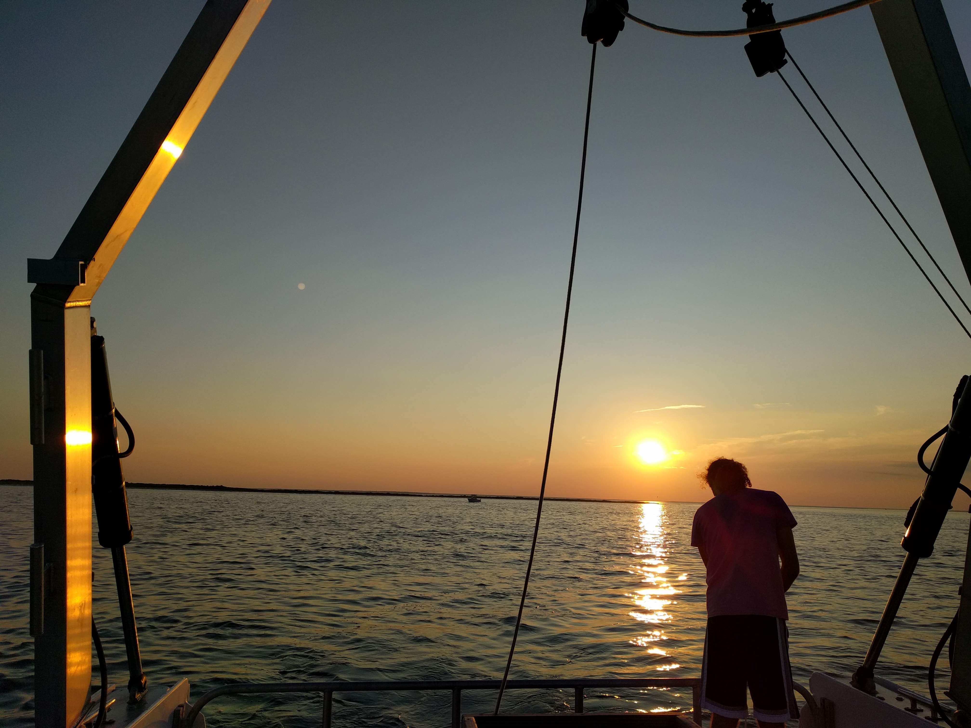
Marine Science major Nicole Ertle watches as USGS equipment is deployed from Stockton's R/V Petrel to map the seafloor. Credit: Steve Evert
In 2018, the U.S. Geological Survey chartered Stockton University’s research vessel, the R/V Petrel, to map the region beneath the surface of Little Egg Inlet and to characterize its sub-bottom profile. Anna Pfeiffer-Herbert, assistant professor of Marine Science, is expanding on this work by describing how water flows through the inlet.
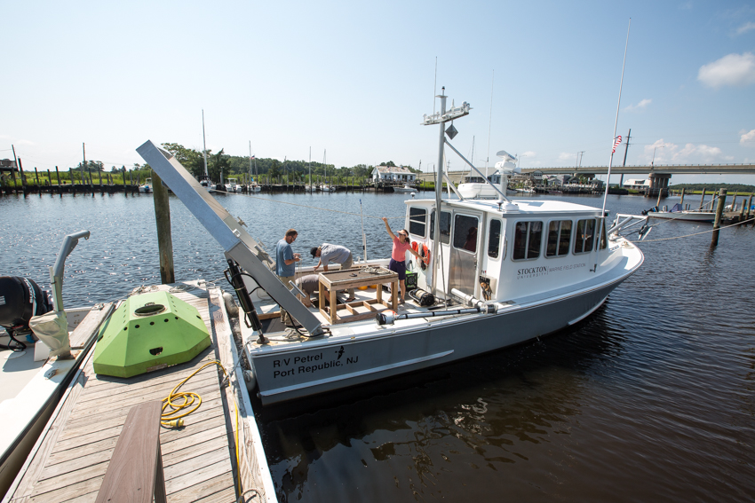
Stockton’s Marine Field Station, located on Nacote Creek, is a short boat ride from Little Egg Inlet, which is one of the state’s last and largest natural inlets. The absence of man-made modifications, such as jetties for stabilization, and no dredging up until 2018 have allowed sand to migrate and respond to storms naturally.
Understanding how tidal and wave energy affects the functionality of natural and modified inlets can inform scientists on how management impacts natural coastal processes.
Water moving through Little Egg Inlet transports sediment between Great Bay and the ocean. Anna Pfeiffer-Herbert’s research is determining the volume of water flowing through the inlet with each tide, how fast water can pass through the inlet, the path of the sediment as it moves and how erosion can alter the inlet’s functionality.
An understanding of flow through an inlet offers insights into water quality. Sediment accumulation can cause a restriction in water flow, and a stagnation can cause water quality to decrease, explained Pfeiffer-Herbert.
In the new year, Pfeiffer-Herbert and students will work out of the Marine Field Station to continue surveying flow patterns using Stockton’s Acoustic Doppler Current Profiler (ADCP), an instrument that uses sound to measure the speed of water as it moves across a column of water or from shore to shore.
Work to model how the inlet works will enable predictions to be made in the future.
View the photo story below by Susan Allen. For more about the Marine Field Station and the research it supports, visit the website.
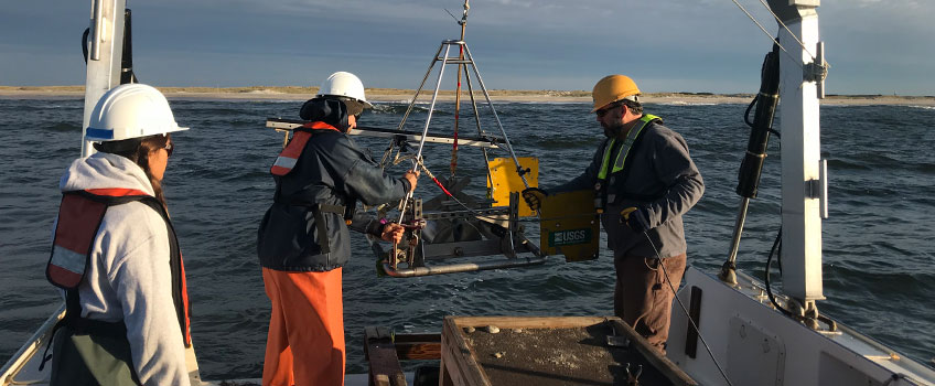
Over the summer and fall, the U.S. Geological Survey deployed their equipment from the Petrel to map the underwater terrain and penetrate the bottom to describe the layers. They also collected sediment samples to confirm their sub-bottom profile. Video Credit: Steve Evert of the Marine Field Station for USGS. Visit USGS, for a drone view.
An Acoustic Doppler Current Profiler mount rests on the Marine Field Station dock before it is lifted onto the R/V Petrel.
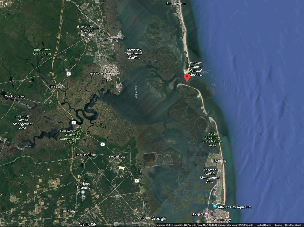
From the Marine Field Station, the Little Egg Inlet is a short ride down Nacote Creek, into the Mullica River and through Great Bay. Credit: Google maps
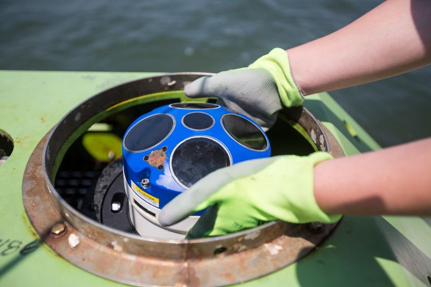
An Acoustic Doppler Current Profiler is carefully placed into its mount. The green pod is the frame that holds the ADCP and anchors it to the bottom. This configuration measures water flow in one spot over time.
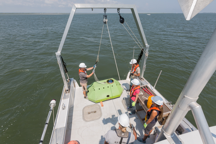
The ADCP is hoisted into the water. It will sink to the bottom and begin collecting data on how fast water is flowing from the bottom all the way up to the surface.
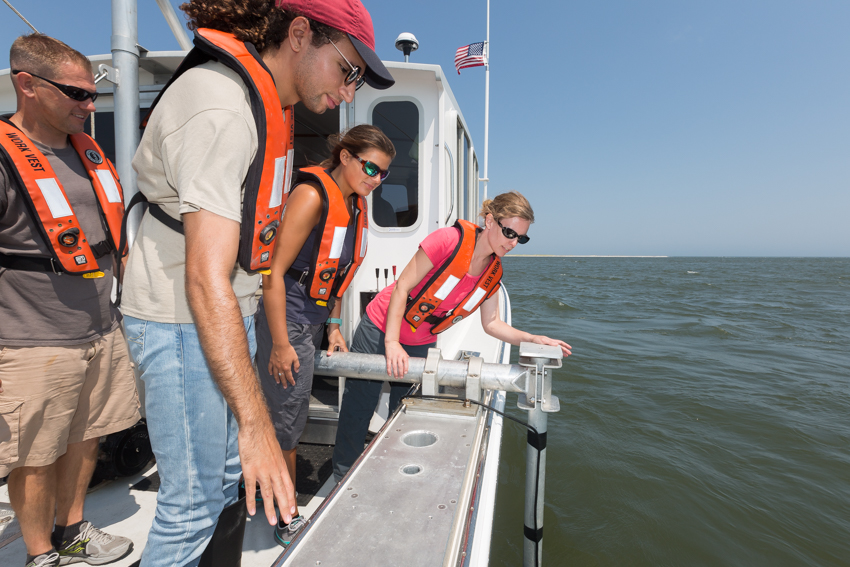
Anna Pfeiffer-Herbert deploys an ADCP that is suspended on a pole over the side of the Petrel. Senior Marine Science majors Nicole Ertle and Robert Cacace and Nathan Robinson, Marine Field Station assistant, stand by. This is the configuration used for surveying the water flow while Steve Evert, associate director of the Field Station, navigates the boat along a designated circuit.
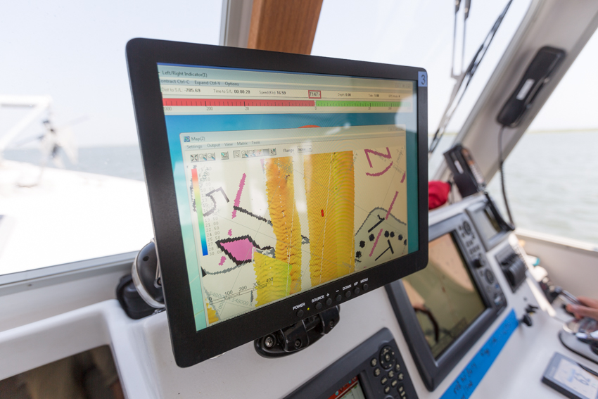
Inside the R/V Petrel, a computer screen displays multibeam sonar data of seafloor bathymetry.